|
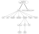
This case study illustrates:
(1) Tools for analysing and reporting on the
semantic structures of attributes associated with shapefiles:
(2) Working with
hierarchically structured attributes (eg: rock types):
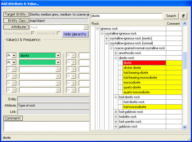
| Selecting a rock-type during
attribute input: |
 |
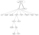
(3) Working
with lists of "same-type" attributes (eg: two rock types in the same
polygon; many minerals in same rock):
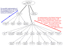
| Semantic net storing two rock types
in one polygon (psammite and pelite). |
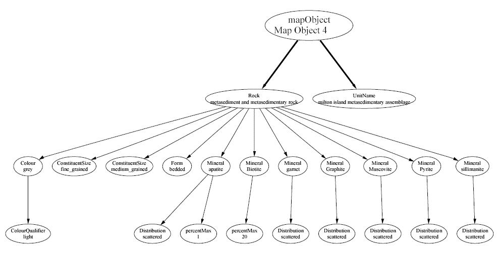
 |
| Semantic net storing details of
many minerals in one rock. |
 |
(4) Storing information about compound objects
(eg: rocks made out of rocks):
| Storing a description of
intercalations which details the rock types within them. |
 |
| Storing a description of anorthositic
and gabbroic bands in a schist. |
 |
|
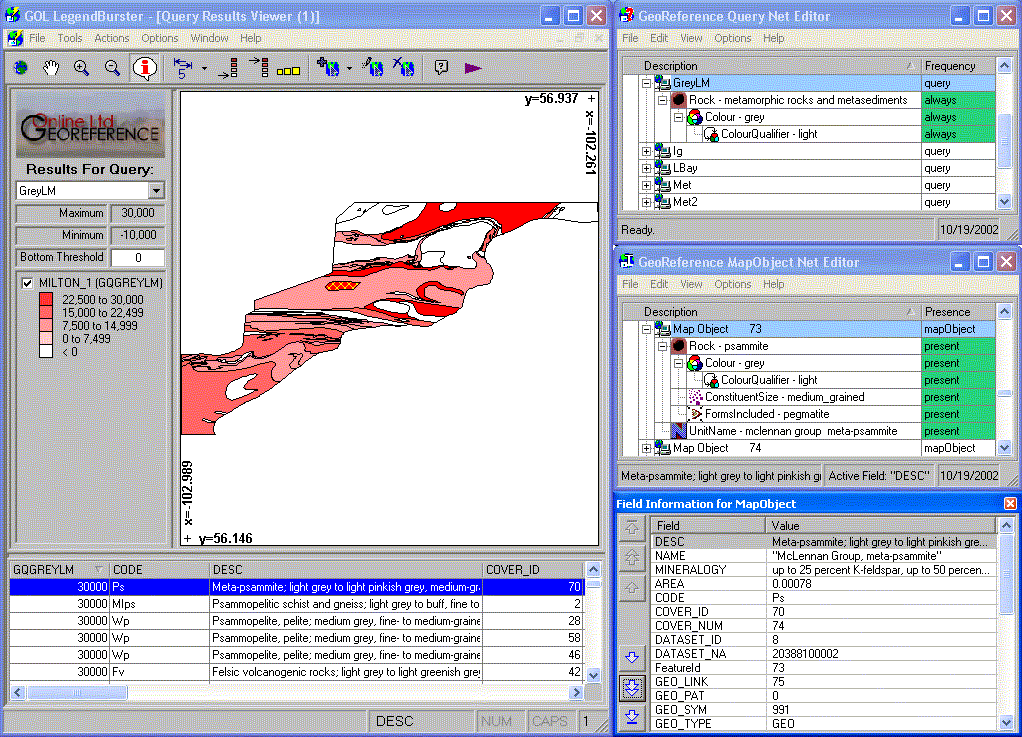
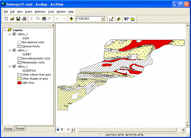
(5) Displaying close and intermediate matches to a query:
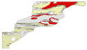
| "Show metamorphic rocks that are
light grey". [Red => a perfect match; Medium red => "grey
metamorphic rocks"; Light red => "metamorphic rocks". |
 |
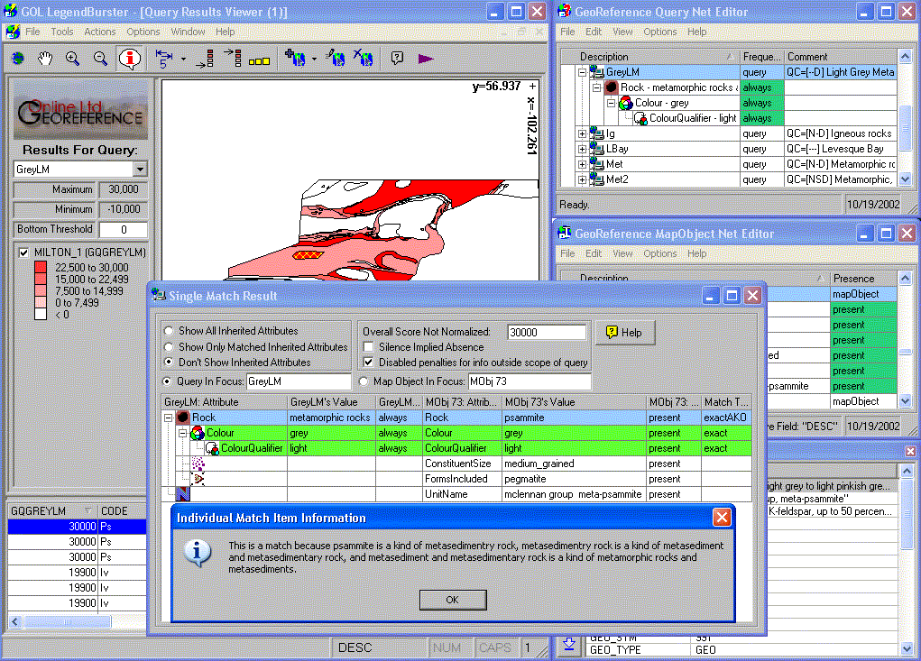
(6) Providing explanations:
| "Explain why polygon 73 is a perfect
match to the query" |
 |
(7) Combining the results of multiple
LegendBurster queries into one map:
| "Find igneous rocks"
+ |
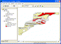
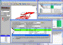
(1) ArcGIS 8 Screenshot
(2) Interactive map in web browser (160 Kb). Click
on polygons to see all original shapefile attributes. |
| "Find metamorphic rocks"
+ |
| "Find all light grey rocks" |
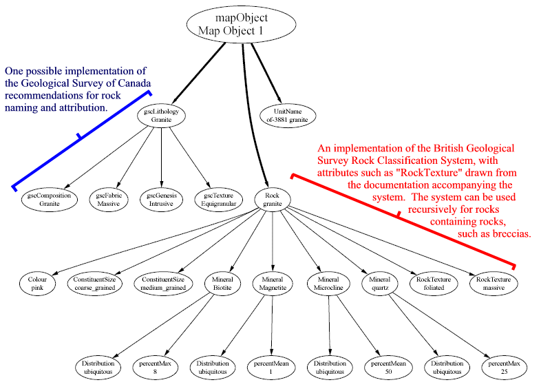
(8) Comparing different classification systems
| Using the BGS Rock Classification
System [view]
alongside the GSC-proposed system [view]. |
 |
|